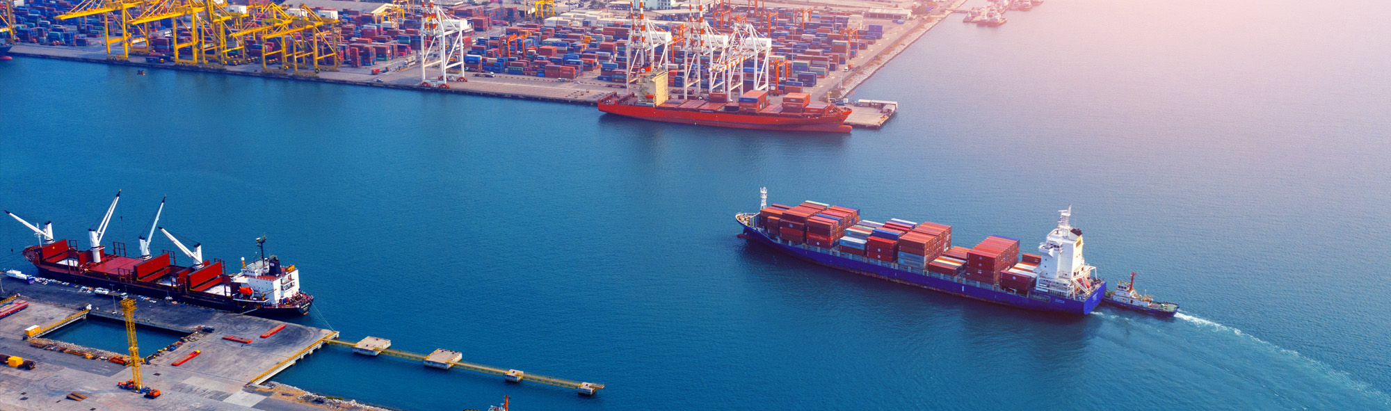
Real-Time Channel Conditions for Safe Deep-Draft Transit
Continuous wave, current, and tide data from the transit zone enables accurate under-keel clearance (UKC) calculations and confident go/no-go decisions before tidal windows close.
What You'll Achieve
Accurate UKC Calculations from Actual Conditions
Replace regional tide predictions with transit-zone water level data, eliminating 0.3m discrepancies that strand vessels or force conservative holds.
Confident Go/No-Go Decisions Within Tidal Windows
Give pilots the site-specific wave, current, and tide data they need to commit to transits early enough to complete them before depth becomes limiting.
Reduced Weather-Related Delays and Missed Windows
Distinguish between conditions that genuinely require holds and forecasts that prove overly conservative, recovering transits that would otherwise wait 6-12 hours.
The Gap Between Predicted Tide and Actual Channel Conditions
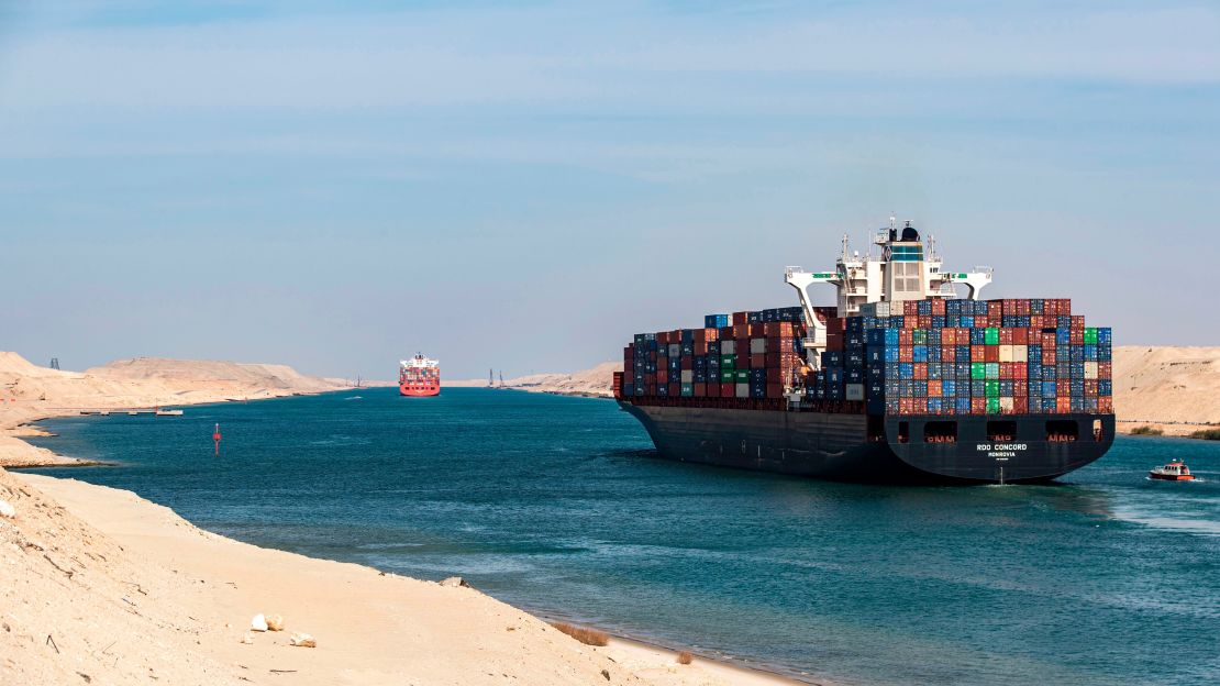
When a 14-meter draft vessel needs to transit a channel with 15.5 meters at predicted high water, the margin for error is measured in centimeters. Pilots must account for squat at transit speed[1], vessel motion in swell, and the critical question: will actual tide match the prediction? A 0.3-meter shortfall doesn't just reduce safety margins. It can mean grounding or a 6-12 hour wait for the next window.
The problem is that tide predictions represent regional averages, not the specific transit zone 1-6 nautical miles offshore[2] where pilots need data. Cross-currents that require crabbing down the channel add complexity to an already tight calculation[3]. Traditional monitoring infrastructure clusters at berths and harbor entrances, leaving the approach channel—where deep-draft vessels are most constrained—as a data blind spot. Pilots compensate with conservative margins that sacrifice efficiency, or they accept uncertainty that occasionally becomes expensive lessons.
Site-Specific Sensing Where Pilots Make Critical Decisions
What Gets Deployed
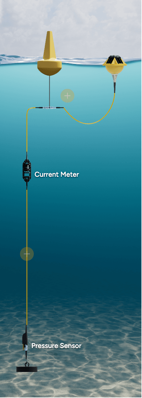
Because the transit zone is where under-keel clearance becomes critical, that's where monitoring must be positioned. A sensing network placed along the approach channel captures the actual conditions pilots need (not interpolated from distant stations or extrapolated from regional models). Wave buoys measure swell that causes vessel motion, current meters capture near-channel flows that require crabbing compensation, and pressure sensors deliver real-time water level data that either confirms tidal predictions or reveals the 0.2-0.3 meter deviations that change decisions.
What the Data Reveals
Within hours of deployment, pilots begin seeing how actual channel conditions compare to predictions. Current patterns that seemed uniform reveal directional shifts at specific points along the transit. Water level measurements show consistent offsets from tabulated tide values—sometimes favorable, sometimes not—that explain why certain transits felt tighter than expected. Wave data from the offshore approach provides the advance warning needed to assess whether vessel motion will eat into clearance margins before the vessel commits to the channel.
What This Enables
As a result, pilots can calculate under-keel clearance using measured rather than predicted inputs[4]. The 10% of static draft standard becomes a calculation grounded in actual conditions: actual water level for tide, actual swell height and period for motion estimates, actual current for squat and crabbing adjustments. When conditions support transit, pilots commit with confidence rather than conservative hesitation. When conditions genuinely require a hold, the data provides objective justification that protects both the pilot's decision and the port's throughput from second-guessing. Over time, the continuous record reveals patterns—which tidal cycles consistently exceed predictions, which wind directions correlate with adverse currents—that transform reactive decision-making into informed anticipation.
Case Study
Port of Lyttelton deploys Spotter Platform as primary offshore wave buoy
At the Port of Lyttelton in New Zealand, officials use Spotter as the primary source of offshore wave data.
See full example
Recommended Systems (3)
Because deep-draft transit decisions depend on conditions along the entire approach, not just at the berth or harbor entrance, the monitoring architecture positions sensors where constraints are tightest. A primary station adjacent to the controlling depth captures water level deviations and near-channel currents at the critical clearance point, while an offshore station provides advance warning of approaching wave and current conditions. For ports with longer channels, additional stations may be warranted at secondary shoal areas.
System Overview
Purpose
Delivers real-time water level, current, and wave data near the location where under-keel clearance is most constrained
Deployment Context
Moored adjacent to the maintained channel near the controlling depth, offset from the traffic lane to avoid obstructing transiting vessels while remaining close enough that water level and current measurements reflect conditions across the channel cross-section
Sensors
Required
Pressure (Depth)
Measures real-time water level near the controlling depth, capturing 0.2-0.3m tidal deviations from predictions that determine transit feasibility
Current Meter
Measures near-channel cross-current and along-channel flows that affect squat calculations and determine crabbing angles for safe transit
Wave
Captures swell height and period near the constraint point, enabling pilots to estimate vessel motion that consumes clearance margin
Important
Wind
Correlates surface wind with current behavior and provides data for vessel handling assessments during the transit
Sources
- [1]Under keel clearance— Wikipedia
- [2]A high-precision tidal level determination algorithm for an ...— ScienceDirect
- [3]Navigation Channel Design - Coal Harbour— Royalvan
- [4]Under keel clearance— Wikipedia
Use of this content is subject to Sofar's Terms of Use and Privacy Policy.