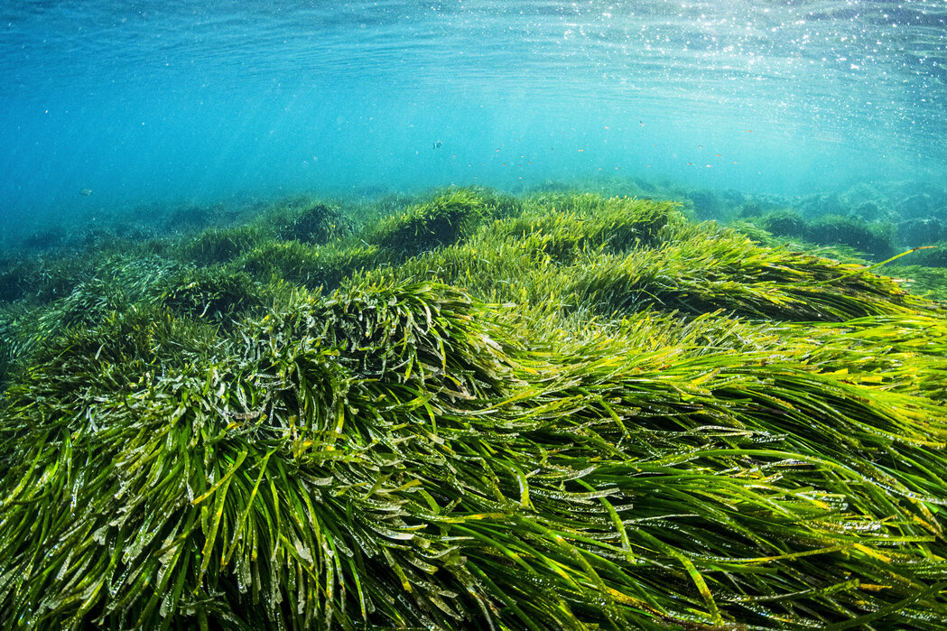
Environmental Baseline and Recovery Tracking for Marine Restoration
Continuous monitoring captures habitat recovery patterns and validates restoration success over months and years.
What You'll Achieve
Establish Pre-Restoration Baseline
Creates the reference conditions necessary to measure change and distinguish natural variation from restoration-driven improvements.
Detect Recovery Setbacks Early
Identifies stress conditions or degradation events as they develop, enabling rapid intervention before restoration gains are lost.
Document Restoration Success
Provides the continuous environmental record needed to demonstrate habitat recovery and justify continued funding or future project phases.
Proving That Restoration Actually Works
Marine restoration projects — whether rebuilding oyster reefs, replanting seagrass beds, or removing invasive species — succeed or fail based on whether habitat conditions actually improve. Funders demand proof. Regulators require documentation. Communities want to know their investment worked. Yet most projects rely on periodic sampling that captures only snapshots, missing the gradual shifts and seasonal patterns that reveal whether an ecosystem is truly recovering.
The capability gap is temporal: restoration outcomes unfold over months and years, not days. Quarterly site visits cannot distinguish a genuine recovery trend from normal seasonal variation[1]. When stress events occur between sampling trips, teams discover problems only after damage accumulates. Without continuous records, projects struggle to demonstrate success, justify follow-on funding, or identify corrective actions before restoration gains erode.
Continuous Environmental Records That Prove Recovery
What Gets Deployed
A distributed sensor network establishes the environmental baseline before restoration begins, then tracks how conditions shift as the ecosystem responds. Stations positioned across the restoration footprint capture spatial variation — comparing conditions inside restored areas against adjacent reference sites. This Control-Impact approach, part of the BACI (Before-After-Control-Impact) framework[2] standard in restoration science, isolates treatment effects from background variation. The network replaces periodic snapshots with continuous observation, revealing patterns that emerge only when data accumulates across seasons and years.
What the Data Reveals
Because the network captures water quality and physical conditions continuously, teams see how temperature, dissolved oxygen, and salinity regimes shift as restored habitats develop. When a replanted seagrass bed begins photosynthesizing, dissolved oxygen levels rise during daylight hours[3] — a signal invisible in quarterly grab samples but clear in daily cycles. Paired PAR measurements confirm whether improving water clarity is actually delivering sufficient light to the canopy to sustain that growth[4]. As restored oyster reefs filter water, turbidity patterns change. Over months, these observations reveal whether habitat functions are improving or whether stress conditions persist despite restoration efforts.
What This Enables
This continuous record enables two critical outcomes. First, teams can intervene rapidly when conditions threaten restoration success — addressing erosion, adjusting planting densities, or modifying structures before problems compound. Second, the multi-year dataset provides the proof required for regulatory compliance, funding justification, and adaptive management decisions. Instead of arguing whether a single sampling event represents true conditions, managers present continuous records that demonstrate trends, quantify variability, and validate that restoration investments delivered measurable environmental improvements.
Case Study
How a coral nursery in Kāneʻohe Bay turned a single Spotter into a community resource
See full example%20(1).avif)
Recommended Systems (2)
The monitoring approach divides into two complementary roles: restoration site stations track habitat recovery, while reference stations document background conditions. For larger restoration areas, multiple site stations may be needed for spatial coverage. Operational note: Long-term deployments require attention to biofouling[5], which can degrade sensor accuracy within weeks during peak fouling seasons. Plan for regular maintenance intervals and consider anti-fouling measures appropriate to your site conditions.
System Overview
Purpose
Captures environmental conditions and habitat functions within the restored area to document recovery patterns and detect stress conditions.
Deployment Context
Positioned within the restoration footprint, with multiple instances deployed across the site as needed for spatial coverage.
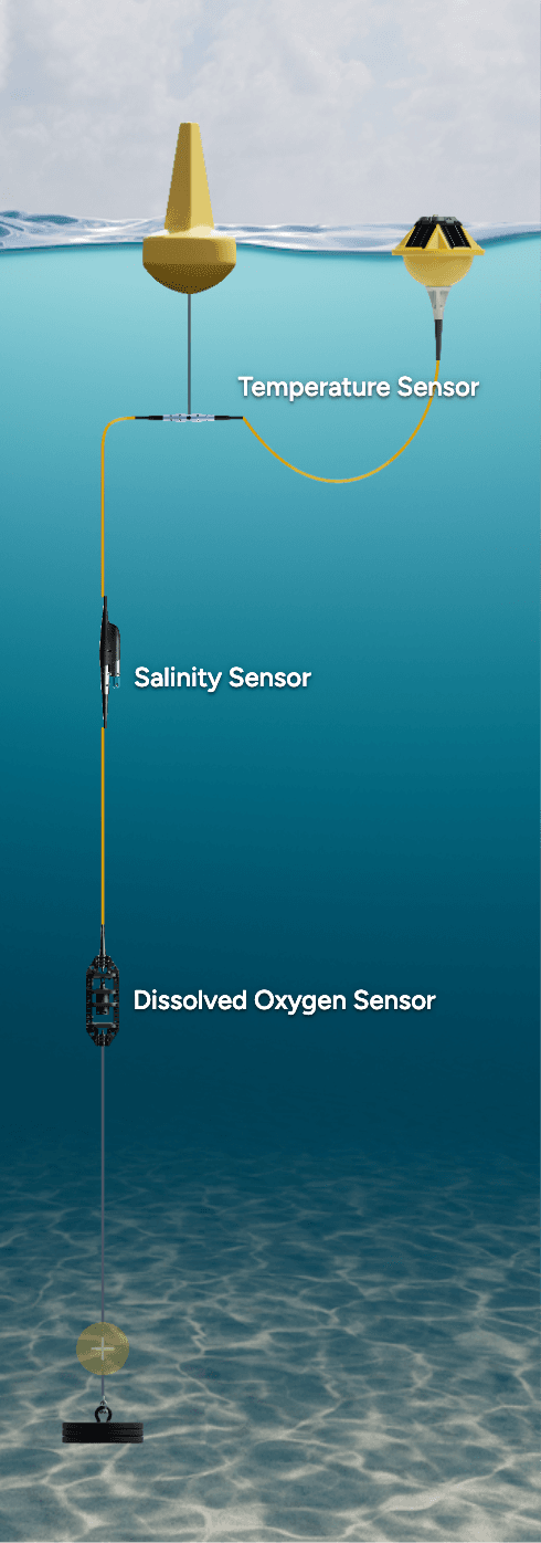
Sensors
Required
Temperature
Tracks thermal conditions affecting species growth, metabolism, and stress — essential for distinguishing seasonal patterns from restoration-driven changes.
Dissolved Oxygen
Monitors habitat productivity and identifies hypoxic conditions that threaten restoration success — daily cycles reveal photosynthetic activity.
Salinity
Documents salinity regimes critical for species survival and habitat function — freshwater intrusion or hypersalinity events can reverse restoration gains.
Turbidity
Tracks water clarity improvements as restored habitats filter sediment — declining turbidity indicates enhanced ecosystem function.
Sources
- [1]Quarterly site visits cannot distinguish a genuine recovery trend from normal seasonal variation— Nationalacademies
- [2]BACI (Before-After-Control-Impact) framework— Frontiers
- [3]dissolved oxygen levels rise during daylight hours— EPA
- [4]Paired PAR measurements confirm whether improving water clarity is actually delivering sufficient light to the canopy to sustain that growth— Doi
- [5]Long-term deployments require attention to biofouling— ScienceDirect
Use of this content is subject to Sofar's Terms of Use and Privacy Policy.